
Fremont Previous Residents by Era
Finding previous residents of a Fremont address means matching the source to the period. Start with the current parcel record so that the street address, legal description, addition, lot, block, and parcel or account details stay together. The deed trail follows ownership interests. Directories and census schedules can place people at an address during selected years. A permit, newspaper notice, obituary, or probate file can narrow a move, construction date, death, or heir question. No one source supplies a complete list of everybody who lived at a property.
| Fremont source | Verified period | Where to use it | Address-history value |
|---|---|---|---|
| Register of Deeds numerical index | 1858-1992 in RG266; online cutoff not located | LandShark, county counter, History Nebraska | Parties, index placement, and legal-description trail. |
| Assessor records | RG266: 1883-1968; online milestone June 2006 | Dodge assessor and State Archives | Owner, legal description, characteristics, and card history. |
| Fremont assessment volumes | 1898, 1900, 1930 subdivisions, and many 1930s-1950s volumes | RG266 / State Archives | Property and assessment clues by addition. |
| Fremont city directories | Microfilm 1903-1936; documented print years 1957-1993 with gaps | Omaha Public Library and related holdings | Names, occupations, and addresses for selected years. |
| Federal census | Public release follows the 72-year rule | National Archives, FamilySearch, local indexes | Household relationships and ages, subject to boundary checks. |
| Building permits | Current application and inspection route; start year not located | Fremont Building Department request | Work timing and file details by address. |
| Sanborn maps | Fremont access confirmed; exact map years not located | Participating library resources | Building footprint and use for a verified map year. |
| Obituary and probate material | Tribune microfilm 1868-June 2013; RG266 probate 1902-1948 | Keene Memorial, county court, History Nebraska | Death, family, heir, and endpoint clues. |
Use the current assessor and LandShark path for a recent ownership question. For an earlier household question, begin with the closest documented directory year, then pair it with the appropriate census. When the record is absent from the web, shift to the Register of Deeds counter, Omaha Public Library microfilm, Keene Memorial, the county court, or History Nebraska instead of filling a gap with an assumption.
The Omaha Public Library Fremont directory holdings identify the documented print years and the 1903-1936 microfilm run.
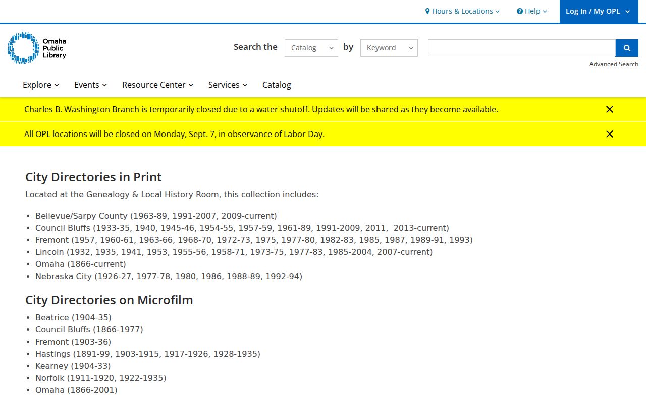
Those holdings are a dated household clue, not a verified reverse directory, so confirm the edition and search its original pages.
Fremont Past Residents Parcel Snapshot
Before tracing previous residents, copy the current Dodge County parcel record exactly. Preserve the owner name, mailing address, situs address, parcel or account identifier, legal description, subdivision or addition, lot and block, sales or transfer entries, sketch or photo reference, and any exemption indicator. The legal description is especially important because it can remain usable when an old directory uses a changed number, a cross street, or a rural label.
The Dodge County Assessor hub provides the current address, owner, account, property-card, and GIS navigation families. The assessor distinguishes a property’s situs from the mailing address for tax correspondence. A mailing address can be outside Fremont or Dodge County, so it is not proof that an owner lived at the property. The current record is a starting snapshot, not a past household list.
For an unavailable or unclear web record, the Assessor office is at 435 N Park, Room 202, Fremont, with main phone 402-727-3911. Historical assessor series and ledger cards have a separate archival route through the RG266 finding aid.
Note: A current assessor result anchors the parcel but cannot establish every person who occupied it in an earlier period.
Fremont Past Residents Deed Chain
The deed chain is the ownership half of previous-resident research. It begins with today’s legal description and walks backward through recorded transfers. In a deed, the grantor is the person or entity conveying an interest, and the grantee is the person or entity receiving it. Because a person can acquire an interest before later conveying it, both party roles matter. A chain of title is the sequence of recorded transfers for the same land interest.
- Save the current assessor owner, situs address, parcel or account identifier, and legal description.
- Search Dodge County LandShark by legal description, address, or parties. Open the purchase deed when an image is available.
- Record the grantee, grantor, recording date, instrument or document number, book and page, legal description, and image reference.
- Search the prior seller as a grantee in an earlier date range while keeping the same addition, lot, block, or legal description.
- When names lead to other parcels, constrain the search with party role, legal description, book and page, parcel, tract index, or instrument group. Continue until the web trail stops, then use the counter or archives.
- Grantor
- The party transferring an interest in a recorded instrument.
- Grantee
- The party receiving that interest. A seller in one deed may appear as a grantee in the prior purchase.
- Chain of title
- A linked sequence of conveyances for the same parcel or legal description.
- Legal description
- The lot, block, addition, tract, or metes-and-bounds land identity used when a street address changes.
The LandShark index displays the recorded-document search modes used for that backward sequence.
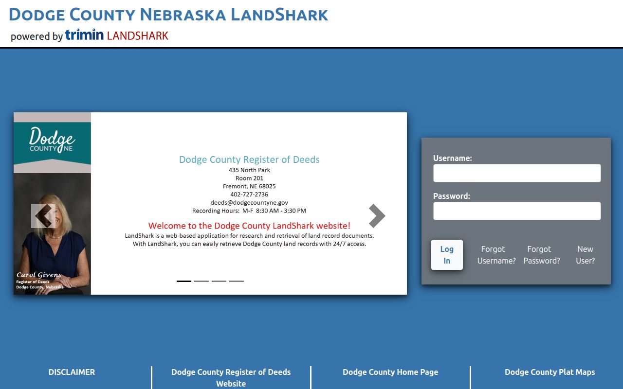
LandShark connects address, party, document, book-and-page, parcel, legal-description, and date searches, allowing one carefully checked result to point to the next.
Fremont Past Residents Index Gap
The current online coverage cutoff for Dodge County LandShark was not located in an official source. Do not state that the portal reaches back to a particular year. LandShark also warns that its working index may contain errors or omissions, that online access can precede verification, and that images and index entries commonly wall-date within about two working days under normal conditions. It recommends using grantor-grantee and advanced legal-description searches rather than relying on one name search.
When the online trail ends, use the Dodge County Register of Deeds in person at 435 N Park, Fremont, or call 402-727-2735. Ask whether the needed book, page, index, or image is original, microfilm, copied security film, or a current image. History Nebraska Reference Services is the archival fallback for the RG266 series. That combination is more dependable than treating a blank web result as the end of a Fremont house history.
Note: An online gap is not evidence that a Dodge County deed or earlier owner record never existed.
Fremont Past Residents, 1858-1992
The key number for the oldest recorded-property trail is 1858-1992. That is the verified range of the Register of Deeds numerical indexes listed in the History Nebraska RG266 finding aid. It is not a claim that every instrument image, parcel card, or searchable name result is online. The same finding aid identifies Dodge County assessor records from 1883 to 1968 and assessment schedules from 1883 to 1963, with real-estate ledger cards from 1953 to 1969.
For Fremont specifically, the archives describe assessment volumes from 1898 and 1900, subdivision material from 1930, many volumes from the 1930s through 1950s, and addition-based cards in the mid-twentieth century. Those groupings can preserve an owner or property clue even when a modern address fails. Keep the addition and block with every transcription because they bridge record systems better than a familiar street name alone.
Fremont Past Residents Fire Gaps
Dodge County’s records history includes two major courthouse fires. The first, on December 31, 1887, caused the loss of many early books. Court-record transcripts had to be created, and George W. Day was paid $120 to reproduce burned books and papers. A second fire on December 5, 1915 destroyed substantial public records. County government operated from the First National Bank building until a new courthouse was dedicated in February 1918.
That story matters when tracing previous residents. A missing volume can reflect loss, reconstruction, or uneven survival rather than a wrong search. Some major records survived, and RG266 lists later series, but record gaps should be expected. Compare an instrument index with assessor volumes, a directory, census material, newspaper microfilm, and the county court or archives before deciding that a person or property has disappeared from the historical record.
Fremont Previous Residents in Directories
Ownership is not the same as residence. For past residents of a Fremont address, use the directory year nearest the event, then compare nearby available editions. Omaha Public Library documents Fremont city-directory microfilm from 1903 through 1936 and print holdings from 1957 through 1993 with gaps. The Nebraska State Genealogical Society catalog confirms volumes for 1961, 1966, 1968, 1985, and 1992. The exact local reverse or criss-cross directory run was not located, so do not promise an address-to-name volume without confirming the edition.
- Capture the exact directory address, name, occupation, spouse or household notation, and abbreviations from the original page.
- Check adjacent documented directory years. A changed occupation can still match when the address, spouse, middle initial, and nearby entries align.
- Pair 1903-1936 directory material with the 1910, 1920, and 1930 federal censuses. Pair later print years with released 1940 and 1950 census access.
- Use Tribune microfilm, yearbooks, obituary material, or cemetery clues to confirm a move or life event. Keene Memorial Library refers requestors to its obituary index, cemetery index, and Tribune microfilm.
- For a death or heir question, check the Dodge County court probate route and History Nebraska, recognizing that probate files are not a complete address roster.
The historical collection details belong with the Fremont City Directory research. For property evidence along a current street, use the Fremont Street Directory path rather than rebuilding a household conclusion from a single old entry.
Note: Record the exact directory edition and page because nearby years can be missing or use a different address form.
Fremont Past Residents Address Continuity
Old sources can describe a Fremont property by street and house number, lot and addition, ward, cross street, or rural and unincorporated label. A dated Fremont street-renumbering or renaming schedule was not located in official sources. Do not invent one when an address does not match. Instead, carry the legal description, owner or seller name, block and addition, nearby streets, and neighboring entries through the next search.
Fremont’s older grid places historic downtown generally south and east of Military and Broad, with rail corridors south of downtown. That geography can make a cross street or addition useful, but it does not replace the legal description. Building permits can also date a construction or alteration event. No public online Fremont permit search was located, so request the original application, permit number, address or legal description, work type, inspection dates, and final status from Fremont permits and inspections under the Nebraska Public Records Act.
Fremont Past Residents Limits
Previous-resident research is strongest when it reports what a particular record supports. A deed documents parties to an instrument, not every person who lived at the parcel. An assessor card ties an owner and property facts together, not every household member. A directory is a dated entry with its own gaps and abbreviations. Census, obituary, probate, cemetery, and permit evidence each need to be read in their own time period and access setting.
Lawful use. Fremont house-history and family-history research should be used for personal, lawful purposes. Do not use a past address trail to stalk, harass, intimidate, or harm any living person.
Sanborn access for Fremont is listed through participating library resources, but exact Fremont map years were not verified. Confirm the map’s year before using it to date a building or an address pattern.